- Location: Western Australia and Northern Territory
- Area: 3,494 square meters. km
- Maximum length: 100 km
- Maximum width: 100 km
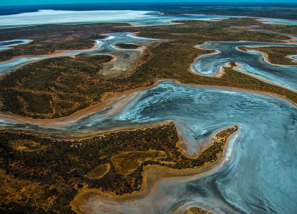
Hundreds of saline lakes scattered throughout the landscape of North and West Australia, and most of them are infrequent and only during seasonal precipitation. In the dry season, water can completely escape into the soil through shallow drainage channels - because of this, the size of the lakes change quite strongly. Some of them turn into salt marshes, and some dry out completely and are covered with salt and gypsum crust.
Named after explorer Donald George Mackay, who, along with his brothers, was the first to bypass Australia , Lake McKay is inferior in size to only the lakes of Katie Tanda Eyre, Torrance and Gurdner - all located in South Australia.
General information
Lake Makkai (in the language of the aboriginal pitjantjatjara - Wilkinkarra) is the largest of hundreds of ephemeral saline lakes scattered throughout Western Australia and the Northern Territory in the Great Sand Desert and the Gibson Desert and Tanami, as well as the largest in Western Australia and the fourth largest in the area on the mainland , covering the surface at 3,494 square kilometers.
The depth of the lake depends on when you measure. In the rainy season, the depth of the largest lakes in the region can reach several meters. Some small small lakes have a depth of less than 50 cm. As for Lake McKay, its depth is uncertain, but presumably it lies somewhere between these two extremes.
Water can be stored in the lake for at least six months after the flood. And during this period ephemeral lake becomes an important habitat and nesting place for waders and waterfowl.
How to get there?
The nearest settlements to the lake are Nyirripi and Kintore. Here you can book an excursion to the lake or take a rental car.
| | | |